Named after Charles Bowyer Adderley, 1st Baron Norton KCMG PC DL JP (2 August 1814 – 28 March 1905) who was a British Conservative politician. Source. Melbourne Council Street Card Number #S371, street gazetted in 1860.

Below you'll find a list of all posts that have been categorized as “Suburbs”
Named after Charles Bowyer Adderley, 1st Baron Norton KCMG PC DL JP (2 August 1814 – 28 March 1905) who was a British Conservative politician. Source. Melbourne Council Street Card Number #S371, street gazetted in 1860.

Spencer Street was named after Lord Spencer, former leader of the Whig party in the House of Commons. Road section running from Flinders Street northwards was gazetted 29 March 1837 by Sir George Gipps, Govener of NSW and the street is thought to have been named after John Charles Spencer, 3rd Earl Spencer, a British statesman. He was notably Chancellor of the Exchequer under Lord Grey and Lord Melbourne from 1830 to 1834. Due to his reputation for integrity he was nicknamed “Honest Jack”. Garryowen’s Chronicles of early Melbourne (1888) quotes from a supposed journal of surveyor Robert Hoddle, suggesting that Bourke instructed Hoddle as to the names of the streets. Such a journal has never been subsequently located, and the precise origin of some names remains a matter of speculation. Spencer, King and William Streets were all later extended in a northerly direction to LaTrobe Street in 1838. In 1860 Sir William Denison, Governor of New South Wales approved the gazettal of a further extension to Spencer, King and William Streets starting from LaTrobe street heading north into the suburb of West Melbourne. Source.(1) John Charles Spencer, Viscount Althorp, 3rd Earl Spencer (1782-1845) by Henry Pierce Bone.(2) NSW Government Gazette,(3) Victorian …

Gazetted in 1860 by the State Government of Victoria and named in honour of John Ward, 1st Earl of Dudley. In 1827 John Ward was appointed Foreign Secretary under George Canning, a post he held also under Lord Goderich and the Duke of Wellington, resigning office in May 1828. In 1827 he was admitted to the Privy Council and created Viscount Ednam, of Ednam in the County of Roxburgh, and Earl of Dudley, of Dudley Castle in the County of Stafford. As foreign minister John Ward was only a cipher; but he was a man of considerable learning and had some reputation as a writer and a talker. Dudley took an interest in the foundation of the University of London, and his Letters to Edward Copleston, the Bishop of Llandaff, were published by the bishop in 1840.(2) Source. (1) National Portrait Gallery London. (2) wikipedia.org/wiki/John_Ward,_1st_Earl_of_Dudley

Gazetted in 1860 by the State Government of Victoria and named in honour of General James Alexander St Clair-Erskine, 3rd Earl of Rosslyn. Source. (1) National Gallery of Scotland, General James Alexander St Clair-Erskine, 3rd Earl of Rosslyn. Photographer, Friedrich Emil Ernest Theodore Schenck.

Gazetted in 1860 by the Victorian parliament, Stanley Street West Melbourne was named after Edward George Geoffrey Smith-Stanley, 14th Earl of Derby, KG, GCMG, PC, (29 March 1799 – 23 October 1869) who was a British statesman, three-time and, to date, the longest-serving leader of the Conservative Party for the Commonwealth. Source. National Portrate Gallery London, Lord Derby, photographed by John Clarck before 1869.
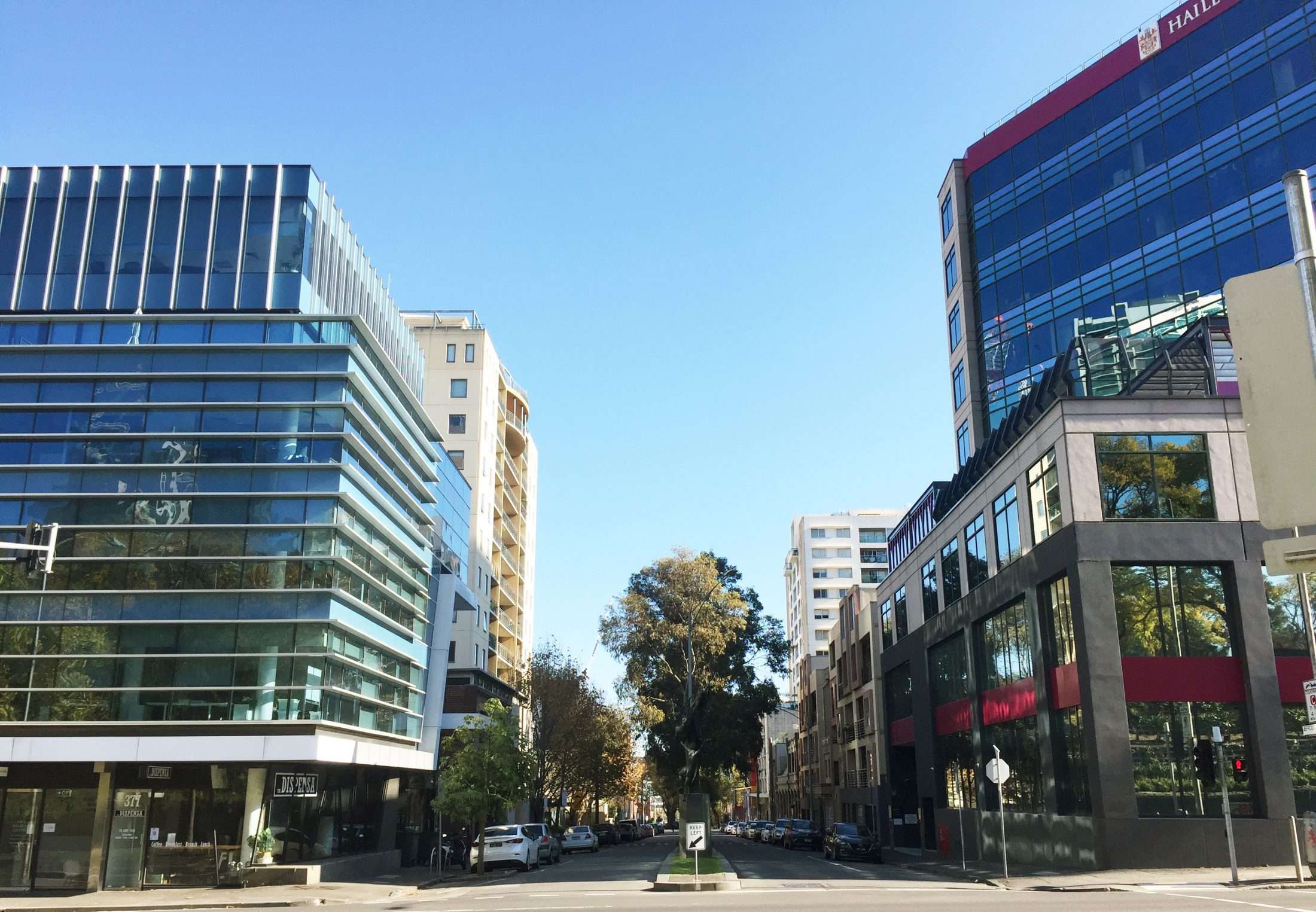
Named after Sir William Jeffcott (1800 – 1855) he was an Irish barrister, a judge of the Supreme Court of New South Wales for the District of Port Phillip from 1843 to 1845.(1) Source. (1) Jeffcott, Sir William (1800–1855)”. Australian Dictionary of Biography. Canberra: Australian National University. TOWN ALLOTMENTS. A considerable number of new allotments have been surveyed and marked out for sale, between the Flag Staff and the Swamp, abutting upon La Trobe and Spencer-streets, and a new street called after Judge Jeffcott. They will not, however, be put up to sale except upon special application, and under any circumstances we should recommend their being withheld, till the removal of the boiling-down establishments has rendered the neighbourhood a little less obtrusive upon the ollactories. We have before noticed the abandonment of the lane system, which has been productive of so much mischief. The streets are all marked out of equal width, but we doubt whether a narrowing of the blocks would not prove a still further advantage, in decreasing the tendency to the creation of rookeries, narrow rights of way, and other nuisances. In future, town allotments are only to consist of a quarter acre each, the frontage remaining …

Named after Richard Cobden, apostle of Free Trade, and relentless crusader for the repeal of the Corn Law – a protectionist device which, he said, “took from the poorest of the poor to add to the richest of the rich”.(1) Source. (1) Northern Advertiser, 1972. Blanchard collection, What’s in a Name” at North Melbourne Library. (2) Melbourne Council Street Card Number #520, street gazetted in 1867.

Wood Street is quite short, running in an east west direction between Abbotsford and Dryburgh Streets on the side of Hotham Hill. When settlers arrived in 1835 the area was the lightly treed grassland of a clan of the Kulin Nation. To the north the land rose up to what became Royal Park. One block north of Wood Street is the current Pleasance Gardens which had a rocky outcrop, said to have caves, and this spot was likely a gathering place for the local clan. In the 1850s rock was quarried where Carroll Street now meets the Gardens. To the south the land sloped down to a creek and a vista containing a blue saltwater lagoon. Initially the settlers used the land to graze their cows. As Melbourne expanded in a north-west direction the Hotham Hill locality was divided into “town allotments”. There were seven allotments on the north side and seven on the south side of Wood Street (as yet unnamed), see detail from Public Lands Office map 14 October 1858. These allotments were auctioned at government land auctions on the 28 December 1865 (north side) and 8 January 1866 (south side). The persons buying there allotments were likely …

Named after William Mountford Kinsey Vale who came to Victorian from London in March, 1853. (1) Source. (1) Northern Advertiser, March 1, 1973. Blanchard collection, “What’s in a Name” at North Melbourne Library. (2) Melbourne Council Street Card Number #1147, street gazetted in 1867.
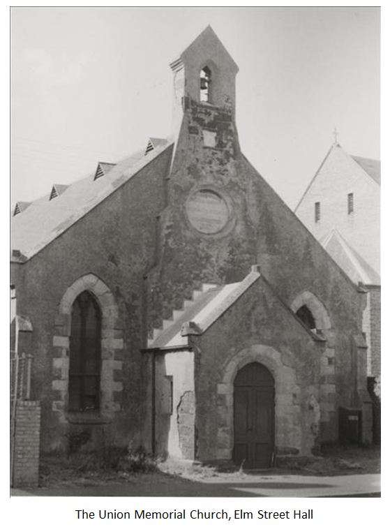
In December 1854 two acres of land facing Curzon Street of the block bounded by Queensberry, Abbotsford & Elm Streets, North Melbourne were given to the Church of Scotland (Presbyterian). The street dividing this area from the rest of the block was initially named Church Street. Scottish Presbyterians brought their church divisions to Australia. These were; — the Established Church of Scotland — the United Presbyterian Church, a union of early secessions from the Mother Church — and the Free Church of Scotland — formed by the “disruption” of the Church of Scotland in 1843. The divisions sprang from differences on questions of theology, Church and State, and the relation of church authority to the individual conscience. Members of the three Presbyterian churches living in North Melbourne all agreed to worship together, a minister of each church coming from another parish to officiate in turn. In September, 1855, after worshiping for a time in a smithy in Villiers Street and then in a stable loft in Errol Street, services began in an iron, building “The Scots Presbyterian Church” on the Curzon Street site. During the week the building was used as a school and its pupils dubbed It “the tin …